HedgehogCycling.co.uk
Yorkshire cycling website

Beryl Burton cycleway
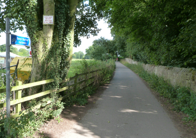
The Beryl Burton cycleway is a traffic-free cycle and walking route from Bilton Hall Drive to the Nidd at High Bridge, Knaresborough. It was developed by Sustrans, to enable cyclists to avoid using the very busy A59.
Beryl Burton cycleway: map
Bilton Lane is shown in green on the above map, and the Beryl Burton cycleway in pink. Waterside and Abbey Road are orange, and the blue loop is a suggested route via Goldsborough and Flaxby. The green markers show the Nidderdale Greenway to Ripley and Harrogate, and the red marker shows the cycle path to Starbeck.
Beryl Burton cycleway: the route
From the Harrogate end, you can access the Beryl Burton cycleway via the Nidderdale Greenway and Bilton Lane. From the Nidderdale Greenway, turn down Bilton Lane, past the Gardeners Arms (on your left on Bilton Lane).
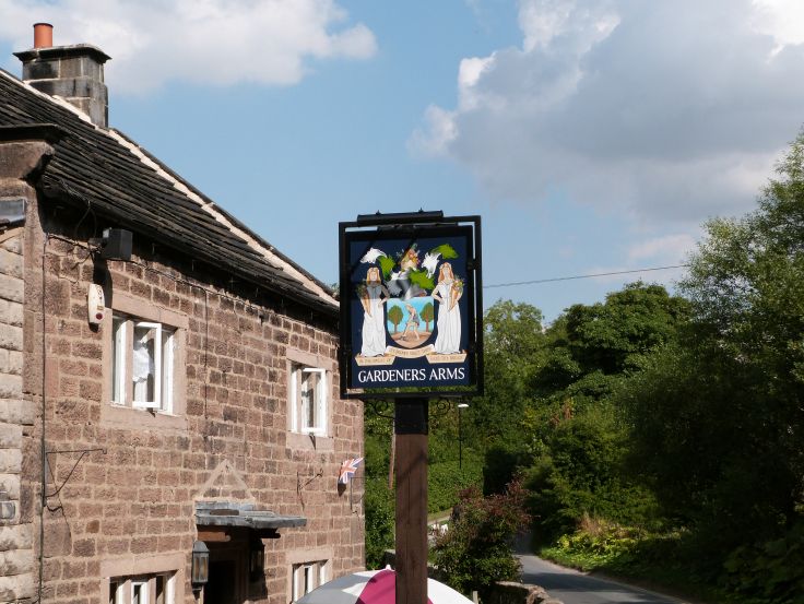
The Gardener's Arms, by Hedgehog Cycling
You then go up the short hill to Bilton Village Farm camping and caravan site. Here, a cycling sign indicates that you continue straight on, towards the Beryl Burton cycleway. In summer 2017, Bilton Lane was transformed from a potholed cart track into a wonderful, smooth ride. Thanks to all involved for their persistence in finally getting this work done.

Bilton Lane/Beryl Burton cycleway near Bilton Village Farm, by Hedgehog Cycling
Bilton Lane is a private road, with traffic limited to access for residents, and a barrier part-way along to prevent other through traffic. As a result, it's nice to walk, run, or cycle, and there are lots of birds in and around the hedges. If you're there early in the morning, you might even see roe deer in the fields either side of the lane. Read more about the Bilton wildlife you might see here.

Roe deer near Bilton Lane, by Hedgehog Cycling
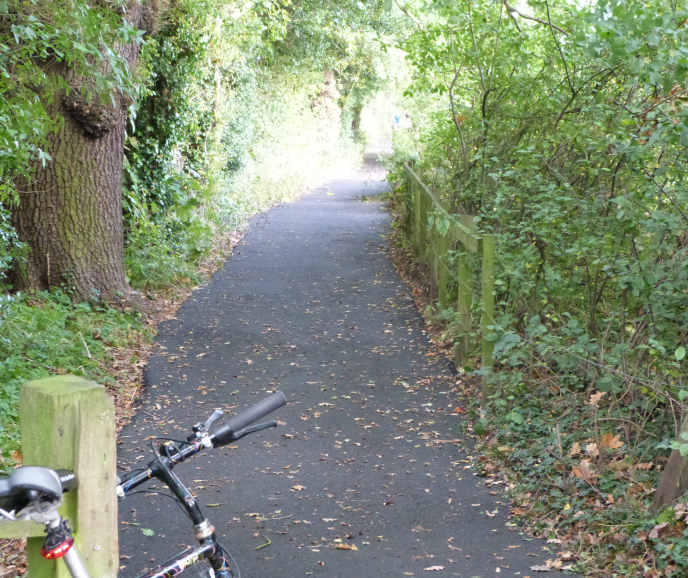
After about a mile, you reach a junction with Bilton Hall Drive, close to Bilton Hall. Continue straight on, down the hill, along a path enclosed by fences/trees/hedges either side. This path is the Beryl Burton cycleway. It was resurfaced in autumn 2013.
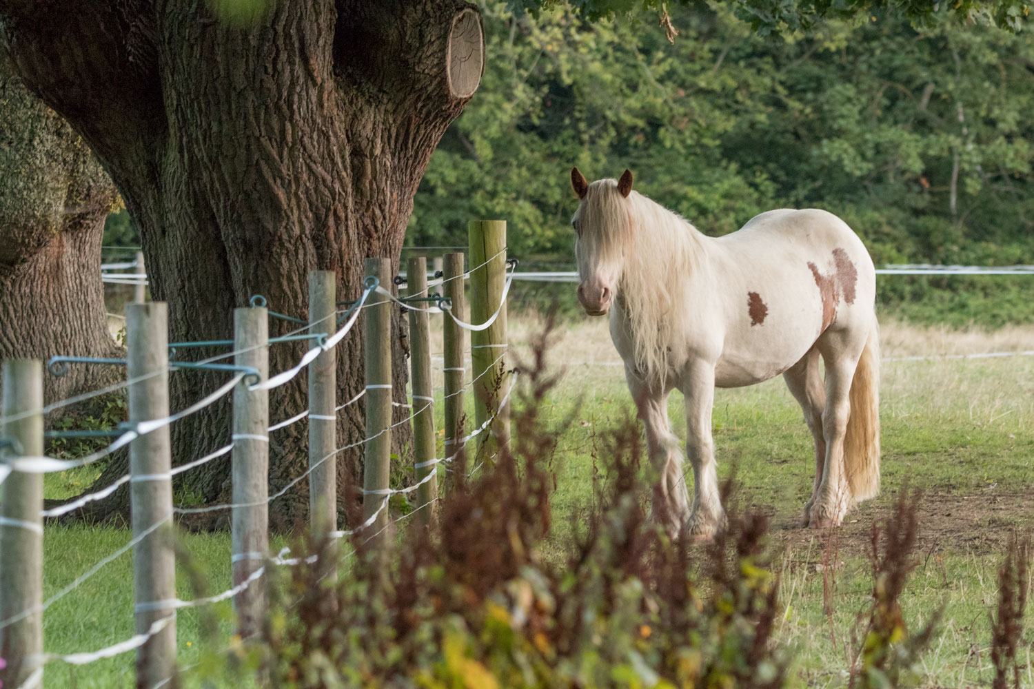
Horses graze in the fields on either side of the path.
There's a small cattle grid by a blue bench, and after that, an open field to the right of the cycleway.

After the next small cattle grid, the path goes through the woods (quite steeply downhill here), and comes out by the Nidd. Turn right along the river, and after a short distance, you emerge onto the A59 where it crosses High Bridge, in Knaresborough.
Beryl Burton cycleway: extending your ride
There are some routes which can be done as an extension of the Beryl Burton route, or to make it a round trip.
Beryl Burton cycleway, extending your ride: bridleway from the Gardeners Arms
If you turn left just before the Gardeners Arms, there's a bridleway (so it can be used by cyclists) called Milner's Lane, which runs past fields and into the woods by the river Nidd. This is really a mountain biking route, with some steep hills, and wooden boarded sections.


After the Milner's Fork junction in the woods, you arrive at the river more or less opposite Scotton Mill. The Ordnance Survey map shows a ford to cross the river and continue on the bridleway on the other side of it, to Bar Farm. However, I couldn't see any crossing that would be practical for cyclists. The map shows the path alongside the Nidd, left towards the Nidd Viaduct, or right towards Knaresborough, as a 'recreational route', but I'm not clear whether that means that bikes are allowed there or not. Tyre tracks in the mud suggest that people do use these paths on bikes; I've also seen non-official signs that someone has put up saying 'no cycling'.

Milner's Fork, by Hedgehog Cycling
Beryl Burton cycleway, extending your ride: Waterside and Abbey Road

World's End pub, High Bridge, Knaresborough, by Hedgehog Cycling
When you arrive at High Bridge, Knaresborough, you can cross the bridge over the Nidd, and go to the other side of the A59, where there's a pub called the World's End. (The pub gets its name from a prophecy attributed to Mother Shipton, that if High Bridge 'is thrice fallen', the world shall end. It is only once fallen so far.)

Tour de France garden, Knaresborough, by Hedgehog Cycling
To the left of the World's End pub is a little Tour de France garden, with metal sculptures of racing cyclists.
To the right of the pub is a road called Waterside, which you can walk or cycle down. It has very little traffic, because it's filtered permeability - there's a barrier part-way along which only residents can open, so it's not a through road for other traffic. Waterside becomes Abbey Road further down. Waterside and Abbey Road are shown in orange on the Google map at the top of the page.
There are sights, attractions, and cafés on Waterside.
Waterside: the Old Manor House

Waterside, Old Manor House, and railway viaduct, Knaresborough, by Hedgehog Cycling
Going down Waterside, you pass the Old Manor House, which dates from 1208. It is said that when King John stayed at Knaresborough Castle, he used to go out hunting in Knaresborough Forest, leaving his retinue under a great oak tree by the river Nidd. When he came back, he would eat under the tree. Eventually, he had a hunting lodge built around the tree; the hunting lodge was transformed into the Manor House; the tree's trunk is still inside the house.
A mulberry tree planted around 1608 at the request of James I, who was trying to encourage the growth of a national silk industry, still thrives in the garden of the Old Manor House. It is a black mulberry, so it never supported silkworms, because they eat white mulberry.
Following the defeat of Royalist forces at Marston Moor (July 1644), it is believed that a Treaty of Capitulation was signed in the house, in the presence of Oliver Cromwell. Knaresborough Castle was besieged by Cromwell's Parliamentarians after Marston Moor. Cromwell stayed in the main bedroom of the Old Manor House during the siege. The castle garrison surrendered on 20th December 1644.
According to the Yorkshire Post, the house has had a small number of owners. After it passed from the Crown to the church, the Archbishop of York lived in it. It was given to the Roundell family, who owned it until the 1950s; it became a tea room, guest house, then restaurant; then it was bought and restored as a private residence in the 1990s.
The chequered black and white paintwork was done by a former owner who was a chess fan. Similar exterior paint has been applied to other Knaresborough buildings, including the entrance to Mother Shipton's cave.
Waterside: boat hire and cafés
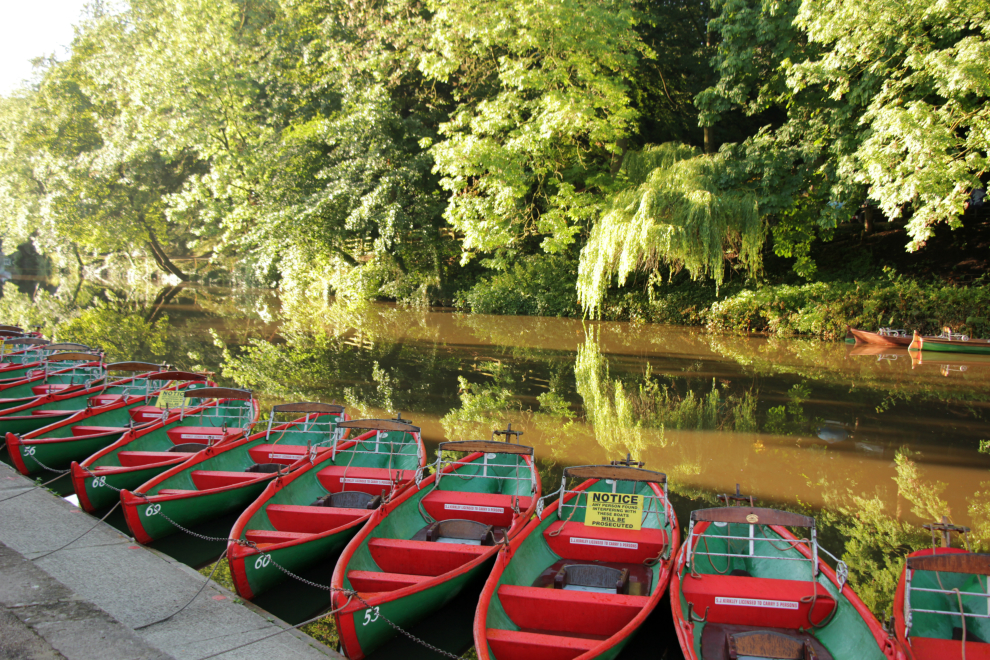
Blenkhorn's boat hire, by Hedgehog Cycling
There are two rowing boat hire businesses on Waterside - Blenkhorn's Boats (red and green) before the Old Manor House and railway viaduct, and Marigold (blue and white boats) after the viaduct. Marigold is also a café, and there are two others on Waterside - the Black Mulberry, and the Riverside Café.
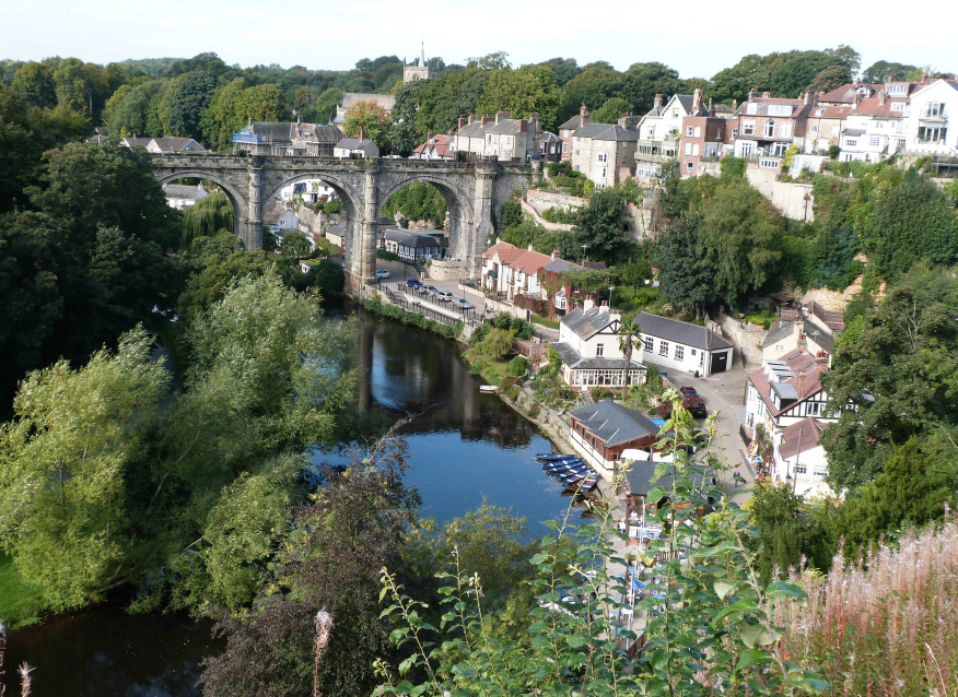
Waterside, Knaresborough, seen from the castle, by Hedgehog Cycling
Continuing along Waterside, you arrive at Low Bridge, Knaresborough, where there's a junction with the B6163 Bland's Hill.

Low Bridge, Knaresborough, by Hedgehog Cycling
Cross straight over the B6163 to continue by the river beyond Low Bridge, now on Abbey Road. Again, it's filtered, rather than a through road, which means it's great for walking or cycling.
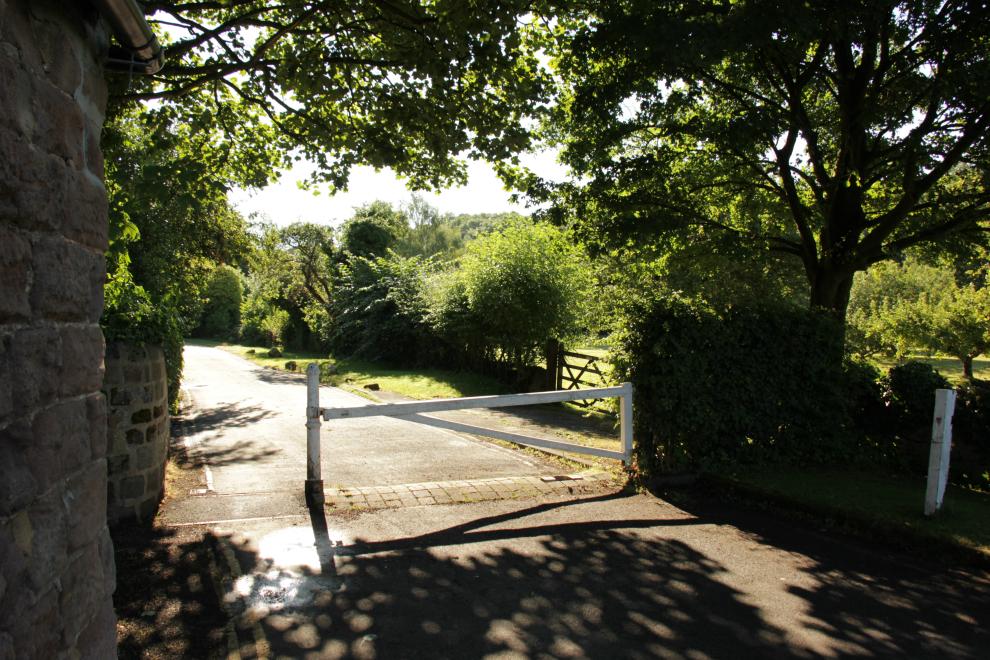
Filtering system on Abbey Road, Knaresborough
There are some minor sights along Abbey Road, including the Chapel of Our Lady of the Crag, the House in the Rock, and St Robert's cave.
Abbey Road: Chapel of Our Lady of the Crag
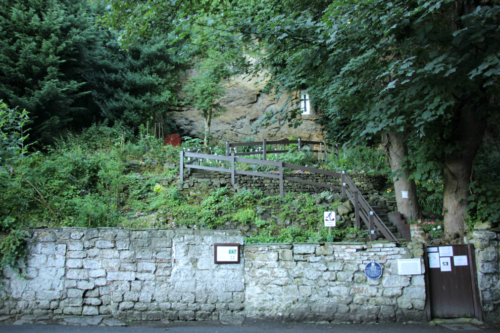
Chapel of Our Lady of the Crag, by Hedgehog Cycling
The Chapel of Our Lady of the Crag, Knaresborough, is a little chapel built into the sandstone river cliff of the Nidd by John the Mason in 1408. It's open to the public on Sundays from 2 to 4pm.
Abbey Road: the House in the Rock

House in the Rock, Knaresborough, by Hedgehog Cycling
The House in the Rock (or Fort Montague) is higher up the river cliff than the chapel. It was built by Thomas Hill, a linen weaver, from 1770. Over 16 years, he dug out the rock of the cliff, from the foot at Abbey Road, to Crag Top, to create a split-level house. He used the stone extracted to build a front wall. The castellations were added later, and at that time, the dwelling was named Fort Montague at the request of the Duchess of Buccleugh, who had helped pay for it.
According to Knaresborough.co.uk, the house was open to visitors until 1994, and lived in by descendants of Thomas Hill until 1996. It may open again in the future.
Abbey Road: carved kingfisher
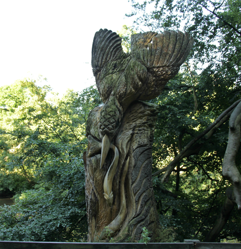
Kingfisher carved into a tree stump, Abbey Road, Knaresborough, by Hedgehog Cycling
Abbey Road: St Robert's cave
Further down Abbey Road, close to the junction with Wetherby Road, is St Robert's cave. Robert of Knaresborough (1160-1218) was a hermit who lived here. He was the son of Touk Flower, mayor of York, and he sought a life of solitude. Initially, he shared the cave by the Nidd with a knight who was hiding from King Richard I, but after the death of the king the knight left, and Robert had the cave to himself. Robert's favourite form of charity was to redeem men from prison.
Return to High Bridge by going back along Abbey Road and Waterside. Alternatively, if you have time and the right type of bike, you could do the Goldsborough-Flaxby loop.
Beryl Burton cycleway, extending your ride: Goldsborough Flaxby loop
This ride starts from the end of Abbey Road, Knaresborough, and takes a mixture of quiet roads and off-road tracks via Goldsborough and Flaxby, then comes back to Knaresborough. Note: there is a short stretch of the A59 to negotiate, perhaps on the grass verge.
Read a route guide to the Knaresborough, Goldsborough, & Flaxby bike route.
Beryl Burton cycleway, extending your ride: cycle path by the A59
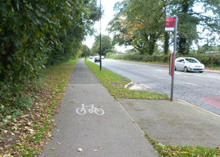
If you want to make a bit of a circuit, from High Bridge Knaresborough you can come back up the cycle path by the A59, as far as Harrogate golf club, then turn right on Bilton Hall Drive to return to the Beryl Burton cycleway. The route is shown in yellow on the Google map at the top of the page.
Cycle path by the A59 from Knaresborough: comments and suggestions
The cycle path by the A59 from Knaresborough is welcome, but could be improved in various ways.
It doesn't start from High Bridge, Knaresborough, but from a little way further up. This means cyclists have to brave a section of this busy road - which in turn means it is doubtful whether it will attract people who find it too dangerous to cycle on the main road.

Cycle path by Knaresborough Road gives way to the entrance to a farm field, by Hedgehog Cycling
Cyclists on the cycle path are asked to give way to traffic turning across it into private driveways - of the golf club, and a farm field. In case we didn't know already, this suggests that cyclists are regarded as the lowest priority on the roads. See my comments in the Hedge-blog.
The cycle path works ok to make a bit of a circuit for anyone riding the Beryl Burton route for pleasure. However, presumably it is intended for utility cyclists, as a way of getting between Knaresborough and Starbeck and Harrogate. It works less well from this point of view, because it is not linked up. It doesn't quite start in Knaresborough, and it dumps you back onto the main road at Harrogate Golf Club. It is an isolated cycle facility, which is the big problem with too many cycle routes in the Harrogate area and in the UK.
It does not start in Knaresborough, and it does not get you to Starbeck or Harrogate. More people will cycle if they know that they can get from their start point to their destination in safety and comfort. Isolated bits of cycle infrastructure do not achieve that.
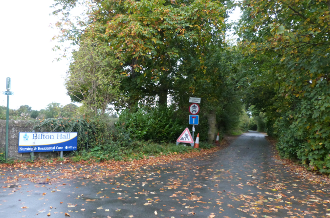
Bilton Hall Drive, by Hedgehog Cycling
Where the cycle path ends at the golf club, there is a lack
of appropriate signage. There should be a sign indicating that the
Beryl Burton cycleway and the Nidderdale Greenway can be accessed
by Bilton Hall Drive . This has now been sorted out.
A bit further up the A59 towards Starbeck, there are cycle signs for Knaresborough and Starbeck, on a lamp post set back from the junction of Forest Lane and the A59. I don't know of any cycle paths to which they could relate, and if they're suggesting that people just ride on the main A59, what's the point of them?


Beryl Burton cycleway: who was Beryl Burton?

Beryl Burton, by Brian Townsley, Flickr, Licence CC BY 2.0
Beryl Burton (1937-1996) was one of Britain's best cyclists. She was born in Leeds, and lived in Morley for most of her life. She raced for Morley CC then Knaresborough CC.
Beryl Burton won more than ninety domestic championships, and seven world titles - five individual pursuit world titles between 1959 and 1966, and the women's world road race title in 1960 and 1967. In 1967, she also set a 12-hour time trial record of 277.25 miles, which was better than the men's record until 1969.
There's mention of her achievements in this Guardian article about the Tour de France coming to Harrogate, and a more in-depth article about her from Cycling Weekly.
This Calendar programme from 1986 features Beryl Burton.
Nidderdale Greenway

The Nidderdale Greenway is a cycleway that runs from Harrogate to Ripley, a distance of about 4 miles. It follows the route of a dismantled railway, so it's largely flat.
Read about the Nidderdale
Greenway.
Knaresborough

Knaresborough is a historic market town on the river Nidd, with a
population of around 15,000. The ruins of Knaresborough Castle stand
high above the river. The market place is at the heart of the town,
and a market has been held every Wednesday since the year 1310. Down
by the Nidd, there's rowing boat hire, and England's oldest tourist
attraction, Mother Shipton's cave. Read about Knaresborough.


© 2016-18 HedgehogCycling
Template design by Andreas
Viklund
