Cycling in Yorkshire & Beyond

Cycling in Yorkshire & Beyond
Stage 10 | Stage 11 | Stage 12

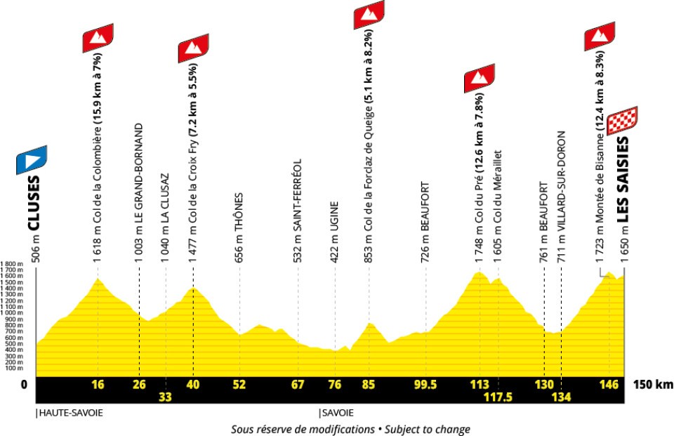
Stage 11 of the Tour de France 2027 is a 150km mountain stage from Cluses to Les Saisies.
The climbs are the Col de la Colombière, the Col de la Croix Fry, the Col de la Forclaz de Queige, the Col du Pré and the Montée de Bisanne.
Christian Prudhomme notes that the descent to Beaufort is technical, so offers an opportunity for an attack.
Race Details | Poll | Map & Profile | Timings | Videos | Food & Drink | Route Notes | Favourites
| Date | Wednesday 14th July 2027 |
|---|---|
| Stage classification | Mountain |
| Distance | 150km |
| Intermediate sprint | TBC |
| Climbs | Col de la Colombière Col de la Croix Fry Col de la Forclaz de Queige Col du Pré Montée de Bisanne |
| Total climbing | 4,750m |
Vote for one of the main contenders to win Stage 11 (to be added later).
This is a map of the route of Stage 11 Tour de France 2027 (to follow).
This is the profile of Stage 11 Tour de France 2027.
| Caravan | Fast Schedule | Slow Schedule | |
|---|---|---|---|
| Start Time (départ fictif) | |||
| Start Time (départ réel) | |||
| Intermediate Sprint | |||
| Col de la Croix Fry Climb | |||
| Col du Pré Climb | |||
| Finish Line (150km) |
This is a video of the route of Stage 11 Tour de France 2027.

Stage 11 is in Haute-Savoie and Savoie. It could therefore be accompanied by heavy mountain food such as fondue, pierrade or raclette.

Vin de Savoie is usually drunk with a traditional Savoyarde meal.
Savoie wines are generally quite light with relatively high acidity. The reds are often made from Gamay grapes, and the whites from Chasselas, Altesse, Chardonnay, Roussanne or other varieties.
Apremont is one of the areas that makes vin de Savoie, generally white wine. The soil is chalky, the result of a landslide from Mont Granier in the 1200s. The slopes enable the vines to catch the morning sun. The main grape variety for Apremont is Jacquère, and the resulting wines are light and dry with floral, mineral character.
Another Savoie wine is Roussette. Buy a bottle of Roussette de Savoie (affiliate link).
The stage starts in Cluses (départ fictif).

Cluses is a town in the Arve valley. Cluse means narrow valley. A bridge was built here in the Roman era, and a village sprang up by it because of the trade that travellers brought.
Clock-making was introduced to Cluses in 1720, with a cottage industry supplying Geneva. In 1848 the Ecole Royale d'Horlogerie was founded, and clock manufacture became a mainstay of the Arve valley.
For many years Cluses was the HQ of the Mitchell Reel company, supplying reels for fishing rods.
The départ réel will be on the outskirts of Cluses, probably at Scionzier.
The riders go uphill straight away, climbing the Col de la Colombière.
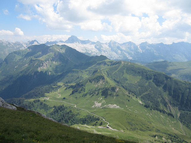
The Col de la Colombière is a climb on the D4 via Le Reposoir.
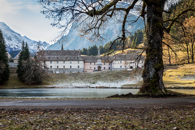
Le Reposoir is a village on a stream called le Foron du Reposoir (a minor tributary of the river Arve).
There was little here before Carthusian monks arrived in 1151. They called the place Le Reposoir, meaning a place of rest for the soul. The Carthusians were expelled in 1901, and the monastery was abandoned for some years. It became a Carmelite monastery in 1922.
The climb continues towards the col.
Alpine Cols said of the ascent from Le Reposoir:
'The sharply steeper road takes a few loops to gain height quickly, and then clings to the NW side of the valley, climbing steadily. With 4km to go it rounds a shoulder and the vista opens up to reveal the distant summit. The chalet is clearly visible as one climbs in low gear up the 9% and 10% grade.'
Overall, the climb is 15.9km at an average 7%. The height at the top is 1,618m.
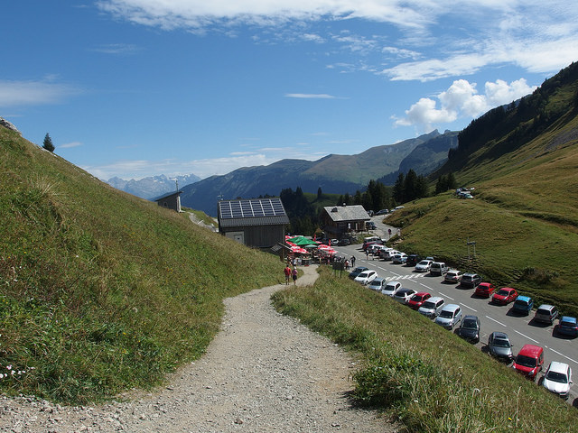
There's a descent from the Col de la Colombière (1,613m) to Le Grand Bornand in the valley (923m). It is not technical.
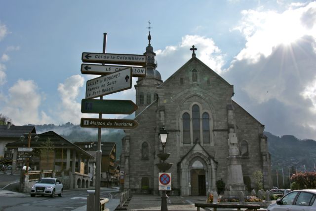
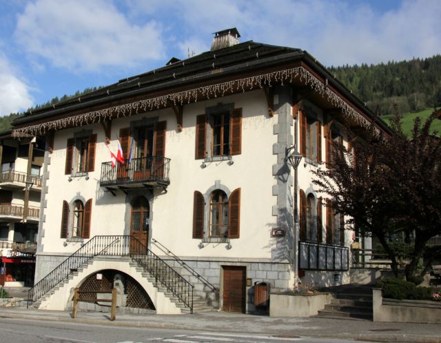
Le Grand Bornand is a village and ski resort in a valley between the Chaine des Aravis to the south east and the Massif des Bornes to the north and west. It's at an altitude of 952m, and there are two télécabines out of the village itself; more lifts serve the main related ski resort, Le Grand Bornand Chinaillon, at 1300m. Ski racer Tessa Worley comes from le Grand Bornand.
The name Bornand probably comes from the Borne stream, which runs down Vallée du Bouchet from the Pointe Percée to le Grand Bornand, plus nand or nant, meaning valley.
There are about 60 farms in the commune, and the principal product is Reblochon cheese.
A traditional chalet in le Grand Bornand has a stone-built lower storey, and the top of the building is wooden. Each chalet has its own mazot, a smaller wooden building without windows, used for storing ham, cereals, and jams.
This video shows the finish of Stage 17 of the 2004 Tour de France in Le Grand Bornand:
Just a few pedal revolutions from Le Grand Bornand is La Clusaz.

La Clusaz is a village and ski resort in the Aravis mountains.
The name La Clusaz means 'narrow or closed valley between two mountains'. At one time, the village was called Clusa Locus Dei, or 'God's narrow place between two mountains', a name given to it by the Abbaye de Talloires, which owned La Clusaz.
The road to La Clusaz, from Annecy and Thônes, was opened in 1902, and this allowed it to become a summer and winter resort. The first cable car was built in 1956.
Famous freestyle and freeride skier Candide Thovex is from La Clusaz.
There's walking and mountain biking in the summer. La Clusaz hosted World Cup parapente events in 2001 and 2003.
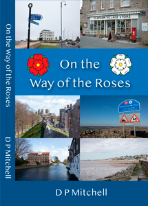
On the Way of the Roses is a humorous and informative look at the places on the route of this long-distance cycle ride.
It provides solid historical and factual information, often in an irreverent style, and with occasional flights of fancy.
The route takes in Morecambe, Lancaster, Settle, Pateley Bridge, Fountains Abbey, Ripon, York, Stamford Bridge, Driffield, Bridlington, and other fascinating places.
Each chapter includes a brief outline of the town's history, then an account of my tour of it. Before leaving, I resolve whatever unfinished business I have - for example, brainstorming extravagant ideas to improve its appeal and attract more visitors.
On the Way of the Roses aims to be an entertaining read regardless of whether you're planning to cycle the route.
On the Way of the Roses on Amazon.
From La Clusaz, Stage 11 climbs the Col de la Croix Fry.

The Col de la Croix Fry is part of the Massif de Manigod, in the La Clusaz ski area.
The climb is 7.2km at an average 5.5%, to a height of 1,477m.
The descent from the Col de la Croix Fry is via Manigod to Thônes.

Thônes is a town at the junction between the Nom and Fier valleys.
It developed as an agricultural centre, with fairs and markets held from the 1300s. It was known for its resistance during World War II, especially from May 1942 onwards.
Today, the economy of Thônes is based on tourism, especially in the winter.
It is still an agricultural centre too - associated with Reblochon cheese. Reblochon originated in this area in the C13th, and it was produced in a clandestine way. Farmers who rented fields from a landowner had to pay a sum proportionate to the amount of milk produced. On the day the landowner came to verify the quantity of milk produced, the farmer would only partly milk the cows, then finish milking after the owner had left.
They made Reblochon cheese from the milk produced by the second milking. 'Reblocher' means to pinch a cow's udder again.
From Thônes, the race takes the D12 uphill to the Col du Marais (843m), then downhill to Saint-Ferréol and Ugine.
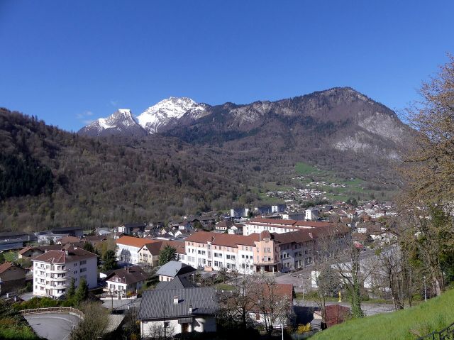
After Ugine, the riders take the minor D67 to tackle the Col de la Forclaz de Queige.
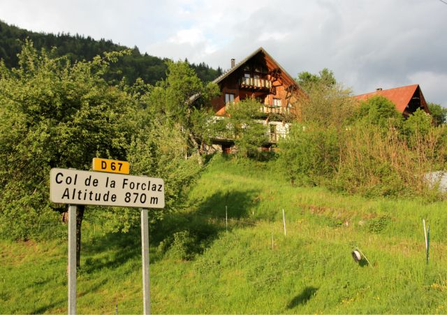
An article in the Dauphiné says that compared with the Col de la Forclaz de Montmin, this one seems:
'more discreet. First of all, because of its size. Ascending to just 870m, this Col de la Forclaz situated above Ugine and Queige is modest, and is easily accessible from the two towns...Not much happens here.'
According to cyclist and fell runner Jean-Louis Perino, 'It's not a well-known place, but it's a little col with a lot of shade, which is really pleasant to do.'
The climb is 5.1km at an average 8.2% to a height of 853m.
There are several Cols de la Forclaz. For example, as well as the Col de la Forclaz de Queige, there is the Col de la Forclaz de Montmin.
According to Charles Marteaux in his 1918 essay on the etymology of the names of some Savoyard places, forclia or forclaz is a Savoyard dialect word which comes from the Latin furcula, meaning small fork.
It signifies a passage which is quite wide to start with, and which
then narrows, making a Y-shape.
Forclaz can also mean two routes which join up in the mountains, forming a V.
The descent to Queige is quite steep. The name Queige comes from the Latin quietus, meaning rest.
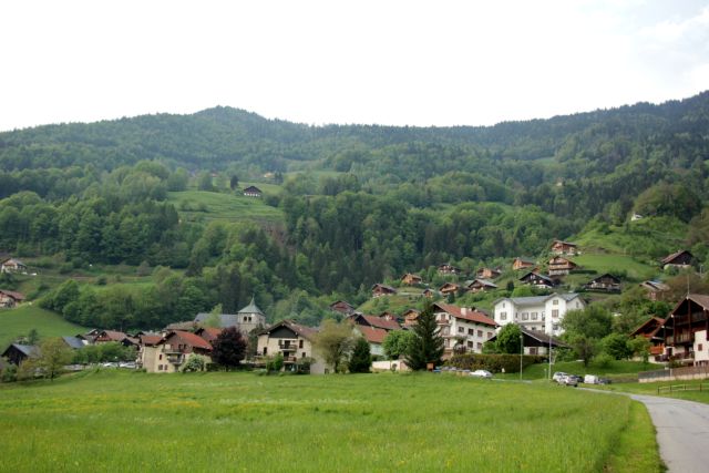
When they exit Queige, the riders will turn left on the D925 (route de Beaufort), which takes them the few kilometres along the valley, by the Doron, to Villard-sur-Doron.
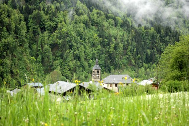
They continue to Beaufort.

Beaufort, or Beaufort-sur-Doron, is a village in the Beaufortain area of Savoie. It's close to the winter and summer resort of Arêches-Beaufort.
Other than tourism, the main occupation is agriculture. The village of Beaufort gives its name to Beaufort cheese (a firm, raw cow's milk cheese similar to Gruyère but nicer).

After Beaufort comes the Col du Pré climb.

inrng said in 2017 that the Col du Pré was an example of the Tour de France using smaller, back road climbs.
The route is via Arêches, and it's after that the road narrows and 'the magic begins' (inrng).
'...[I]t's the stuff of postcards, with chalets, cows, and a sustained slope...there are 15 hairpins in 7km - only with each bend the view down the valley improves.'
The Col du Pré is 12.6km at an average 7.8%, and 1,748m altitude at the top.
2.5km after the Col du Pré, the riders reach the Barrage de Roselend - the dam which creates the Lac de Roselend.

The race goes along the barrage and the lake shore.

The road then meets the main D925 at the Col du Méraillet (1,614m). The Chalet de Roselend Hotel is at the col.

From the Col de Méraillet, the riders descend the D925 back to Beaufort.

They continue to Villard-sur Doron.
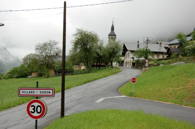
In the Middle Ages, Villard-sur-Doron was home to travelling jewellers, some of whom made a lot of money and built beautiful houses.
Here, the Montée de Bisanne starts.
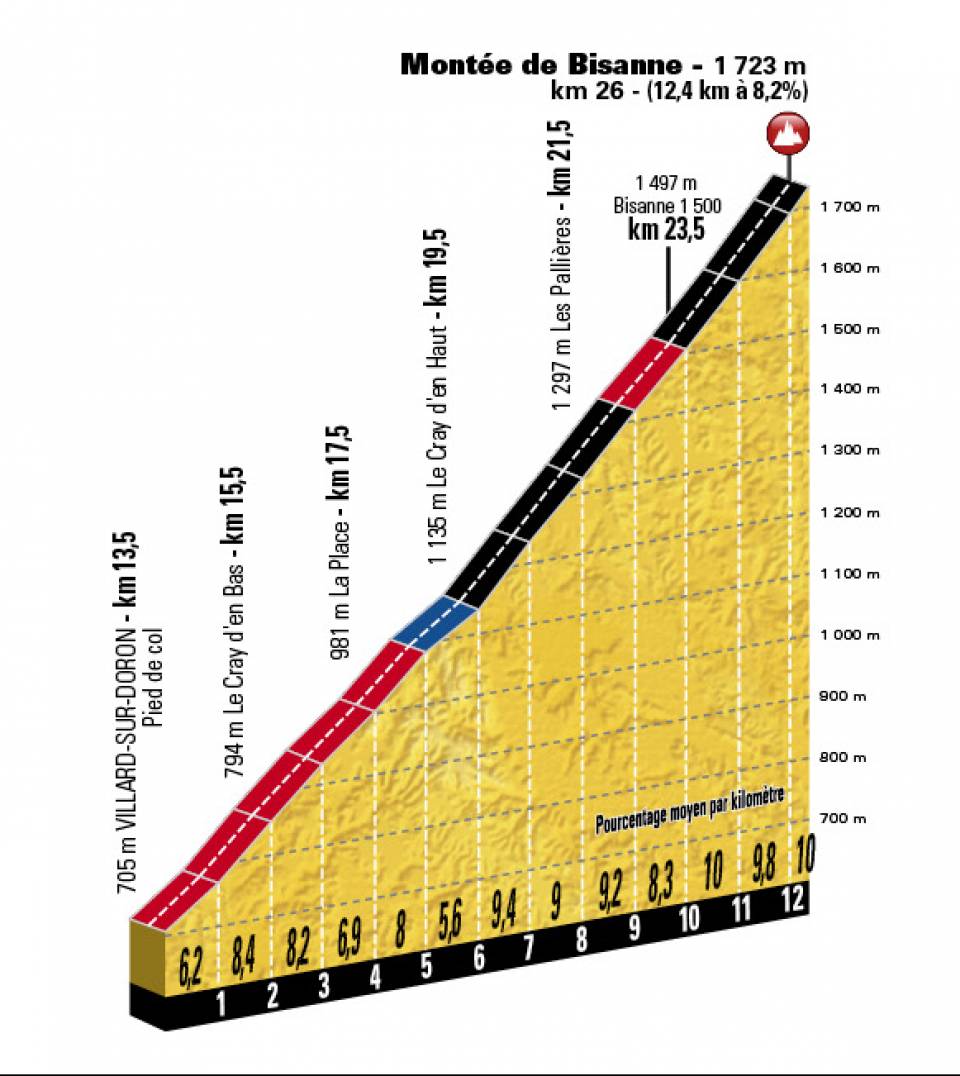
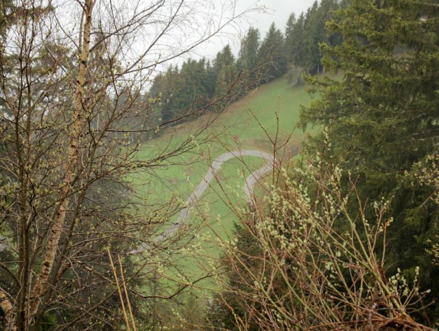
The D123 goes up the Montée de Bisanne, to the ski resort of Bisanne 1500 in the Beaufortain range.
It's unlikely to be as easy as 1,2,3, however, nor indeed A, B, C or do-re-mi. The slope is very steep, although of course the road uses hairpin bends (thirteen of them, by my count).
The climb is 12.4km at 8.3%. The top of the Montée de Bisanne is at 1723m.
The road then goes down a little, before climbing to the ski resort of Les Saisies and the Col des Saisies (1650m).
Stage 11 finishes at Les Saisies.

The name Les Saisies refers to seizures of contraband which were made at a time when it was at the frontier between Savoie and Haute Savoie, in the 1860s.
Les Saisies is a family ski resort, with views of the Mont Blanc range. Although its altitude is modest, the snow record is very good.
An Austrian ski instructor, Erwin Eckl, was central to the development of the resort between 1937 and 1961. He thought the landscape was similar to the Tyrol, and called it 'le Tyrol français'.

Favourites for Stage 11 of the 2027 Tour de France include the usual suspects, Pogacar and Vingegaard.
Remco Evenepoel will hope to do well in the mountains, as will Isaac del Toro and, perhaps, Oscar Onley.
Who do you think will win Stage 11 of the 2027 Tour de France?

Science in Sport 800ml water bottle, price £2.50 from Amazon at the time of writing (affiliate link).
As an Amazon Associate, I earn from qualifying purchases.

Bike Rides in the Yorkshire Dales is available in colour paperback.
Find out more about Bike Rides in the Yorkshire Dales or buy a copy.

Bike Rides In and Around York features a historical city tour, plus family rides, road rides, and mountain bike rides.
Find out more about Bike Rides In and Around York or buy a copy.

Bike Rides in Harrogate and Nidderdale is a book of family, mountain and road bike rides.
Find out more about Bike Rides in Harrogate and Nidderdale or buy a copy.

Find out more about Mountain Bike Rides in the Yorkshire Dales.
Buy Mountain Bike Rides in the Yorkshire Dales at £8 + P&P.

Garmin Edge Explore, £197.99 at the time of writing.
Garmin Edge Explore on Amazon (affiliate link).

Faster by Michael Hutchinson on Amazon (affiliate link).


