Way of the Roses: Route Guide
I've split the Way of the Roses into three stages. These are detailed route guides for each stage, with video, photos and route notes.
Cycling in Yorkshire & Beyond


The Way of the Roses is a 170-mile cycle route from the west coast to the east coast of England. It starts in Morecambe and finishes in Bridlington.
This aims to be a complete guide to the Way of the Roses: map, route guide, videos, information about the places you pass through, and accommodation.
Maps | Route Guide | Videos | Places | Accommodation
This is a GPS map of the route of the Way of the Roses on Plotaroute.
The Maps page has more Way of the Roses maps: a link to the Walk Wheel Cycle Trust map, and the Ordnance Survey Landranger maps that cover the route.
See more Way of the Roses Maps.
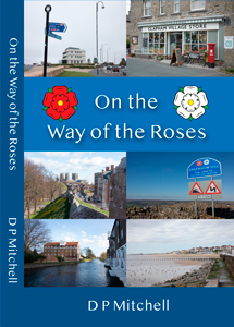
On the Way of the Roses is a humorous and informative look at the places on the route of this long-distance cycle ride.
On the Way of the Roses on Amazon.

The 1:50,000 OS Landranger map number 97 Kendal and Morecambe covers the first part of the Way of the Roses cycle route from Morecambe to Wray.
OS Landranger 97 on Amazon (affiliate link).
I've split the Way of the Roses into three stages. These are detailed route guides for each stage, with video, photos and route notes.

Notes and images for the route of Stage One of the Way of the Roses.

Notes and images for the route of Stage Two of the Way of the Roses.

Notes and images for Stage Three of the Way of the Roses.

Videos of the stages of the Way of the Roses.
The films include footage from a cycle cam, video of some of the sights along the way, and music.
Watch Way of the Roses Videos.
Guides to the places on the Way of the Roses.

Morecambe Bay was known to the Romans as the fourth inlet north of Wales.
The town grew and prospered in the 1800s as the railway brought tourists here.
With the advent of the foreign holiday it declined, but the restored
Midland Hotel and the planned Eden Project could help revive
Morecambe's fortunes.
Read about Morecambe.

Lancaster is a city on the river Lune and the Lancaster Canal.
It started out as a Roman fort, and the castle on that site has been important through the centuries since.
The Port of Lancaster thrived on trade in spices and slaves. The main shipping facility is now downriver at Glasson Dock.
Although Lancaster is a city, it is really more like a bustling market town.
Read more about Lancaster.

Clapham is a Yorkshire Dales village set either side of Clapham Beck.
Ingleborough Hall is the largest house in the village, and was once the home of local landowners the Farrers.
The most famous of the Farrers was botanist and plant-collector Reginald. Today the best-known (part-time) resident is Alan Bennett.
Clapham's Nature Trail leads to Ingleborough Cave, then you can climb
on to Gaping Gill and Ingleborough.
Read more about Clapham.

Settle is a market town in the Craven district of North Yorkshire. It's popular with walkers, mountain bikers and motorbike riders.
Animal bones from the prehistoric period have been found in caves around Settle. The town itself was founded by the Angles in the 600s.
Industry such as cotton mills developed in the 1700s and 1800s. The Settle-Carlisle railway was completed in 1875.
Read more about Settle.

Pateley Bridge is a market town in Nidderdale, North Yorkshire.
There is evidence of Roman activity in the area, notably in lead 'pigs' with Latin inscriptions.
The bridge at Pateley Bridge was first recorded in 1175, and in 1320 the Archbishop of York granted a charter for a market.
The railway came to Pateley in 1862, and in the early 1900s, reservoirs were built above the town to supply Bradford.
Read more about Pateley Bridge.

Fountains Abbey was founded in 1132 by thirteen monks who split from St Mary's Benedictine Abbey in York.
The breakaway team joined the Cistercian order. After hard times at the start, they became wealthy, with agricultural land and interests in mining, quarrying, iron-smelting and milling.
The 1530s was the time of Henry VIII's Dissolution of the Monasteries, and that meant the end for the monks of Fountains Abbey.
Read more about Fountains Abbey.
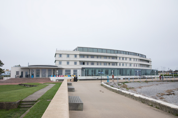
A guide to accommodation on the Way of the Roses, with suggestions for Morecambe and other places along the route.
Read about Way
of the Roses Accommodation.